
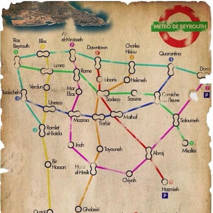
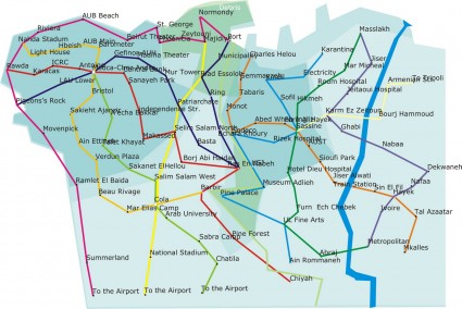
This is a fictional map created by David Hury on his blog “Chroniques Beyrouthines” an old map showing how the Metro could have been in Beirut. Metros and trains are much needed in Lebanon to cut down on traffic and congestion in the cities but we won’t be having any of them anytime soon, even if we manage to extract oil.
While looking for pictures of old Beirut, I found this fictional Metro map from 2009 on MappingBeirut. It was created in order to “add another virtual layer to the psychological and physical labyrinth of the city, focusing on the ever-present demarcation lines that were splitting Beirut during the long period of the civil war, and its relation to the social environment in post-war Beirut.” You can check the full post [Here].
Let’s see how long we’ll keep waiting for the train, or metro to come.


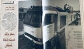
Credit should be given where it is due. This is not “an old map showing how the Metro was supposed to be” but a fictional map created by David Hury on his blog “Chroniques Beyrouthines” illustrating a blog post in 2008: http://chroniquesbeyrouthines.20minutes-blogs.fr/archive/2008/08/21/2049-apres-la-chute-de-beyrouth.html
Thank you Zahi,
I haven’t seen this post until now. Fixed as needed 🙂
lol
i always fantasized and dreamed about a train in lebanon while taking a public bus or a taxi to move around beirut areas … i think the train is better way to commute to avoid all the traffic ..it is a train with a specific railroad …that pass through keys points and gets you to where you want to be or near it …
it may remain a fantasy ..as all the solutions in lebanon are, just a fantasy…
A metro is too expensive to build, especially in Bierut’s case, and not worth the hassle given the small size of the city, and the fact that it is never cold. A good bus system would solve it.
the small size of the city …agreed ..but what about the time spent in traffic, stuck on the road for hours and hours ..that is frustrating …and being late is worse ….and waking up early to not be late is the worst …train a defined railroad, no traffic just on time …hehe