

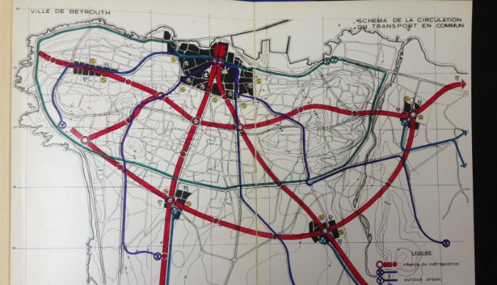
A 1968 USSR Study for establishing a metro in Beirut was shared few days ago by Nabil Nakkash, A Lebanese Transport Systems Engineer. The hand-drawn graphics show clearly the suggested metro lines for the city including typical cross sections, ridership numbers as well as the estimated cost (250-280 Million USD).
Of course a lot of Lebanese don’t believe that it’s possible to set up a metro in Beirut with the lack of urban planning and the poor infrastructure and road network but I agree with Nakkash here that “engineering is never the problem with such projects”. Our problem here is with the corrupt political class and the incompetent ministries.
I shared a couple of pictures but I highly recommend you check out the full article [here] as it contains tons of graphics and more info.
PS: I cannot confirm the authenticity of this study entitled “The evaluation of the possibility and necessity of the organization of the metropolitan (METRO) for the city of Beirut” as this is the first time I hear about it but it looks genuine to me. While looking online, I found two other studies related to urban planning in Beirut, a study done in the 1980s that includes a metro network and another by French architect and urban planner Michel Ecochard back in the 1960s. Apparently, Ecochard worked on the first ever master plan for Beirut.
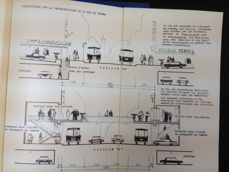 2 suggested cross-sections for Hamra street


Hi Najib,
Thanks for sharing. I realize this is a very important topic for Beirutis and there is a real lack of knowledge to what has been planned or achieved in the years since the end of the civil war, i will try and publish another post soon about that.
Cheers,
Nabil
Great post Nabil. Beirut is in desperate need of a metro system so take some pressure off its roads. As great as that sounds, unfortunately the price for the metro would costs much more than that now. You can assume around $150 million per km for a underground tracks (including the stations and trains). You would think Beirut would attempt to do a P3 project with some of the large companies around the world, but companies will hesitate due to the corruption.
One can only wish that one day a scheme of this sort will be implemented. But it’s also sad that things like this, amongst other large scale infrastructure projects in Lebanon are almost always designed by foreign engineering firms as opposed to having a home-grown urban / engineering initiative.
Why won’t Lebanese engineering firms do research and propose to design a Beirut Metro system? Why the reliance on foreign brains? Looking at Lebanese engineers working abroad, its certainly not a lack of knowledge.